Maps of Vashon Island
Click any of the large maps to view / download (the smaller maps (below) can be viewed as a slideshow).
Downloaded maps can be printed (I recommend using a 11×17” color, laser printer with archival inks).
The main (generic) map of Vashon & Maury Island can be purchased as a poster (3 sizes) or water bottle.
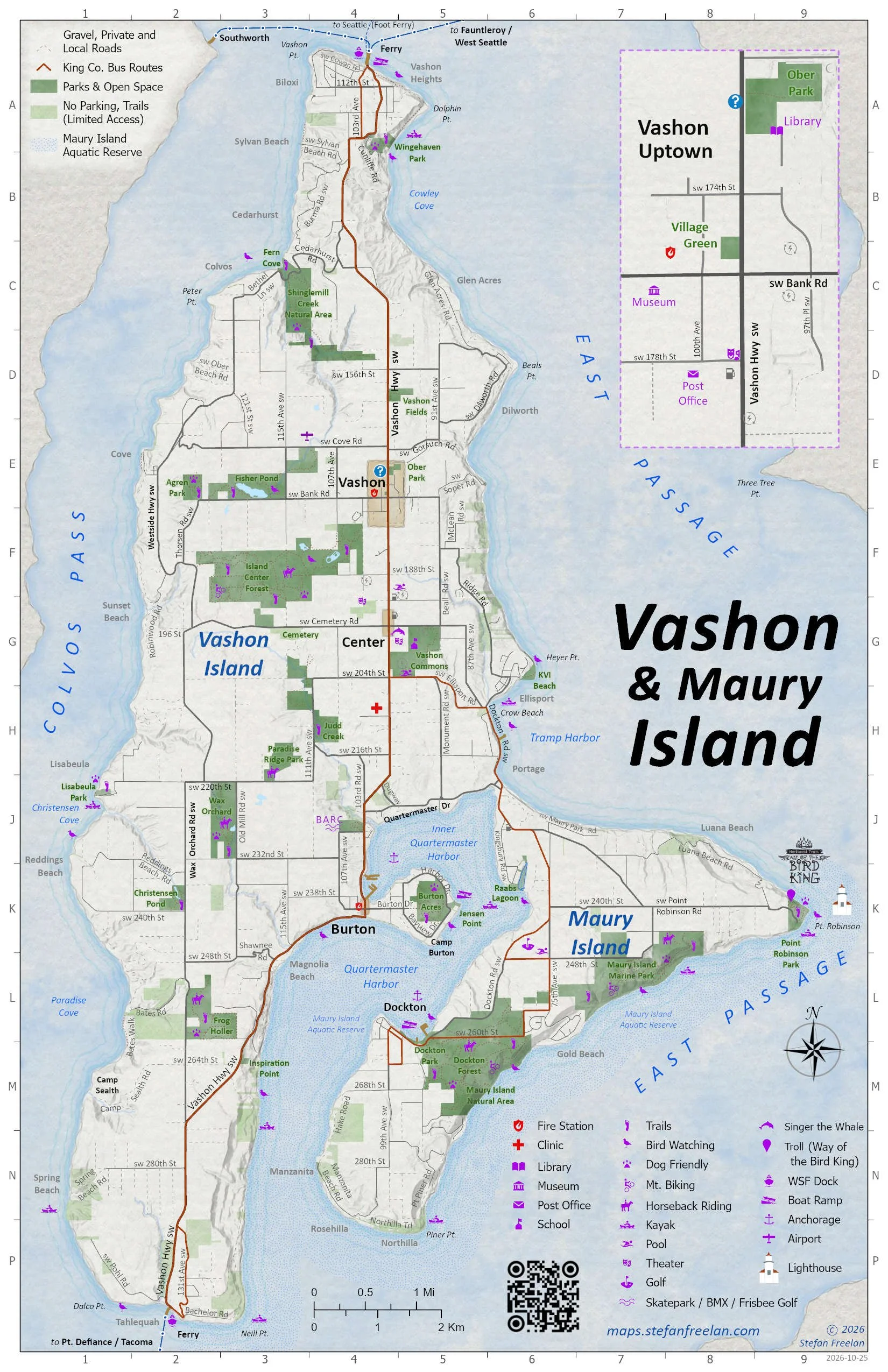
Roads, Parks & Points of Interest. 2026, 11x17 *
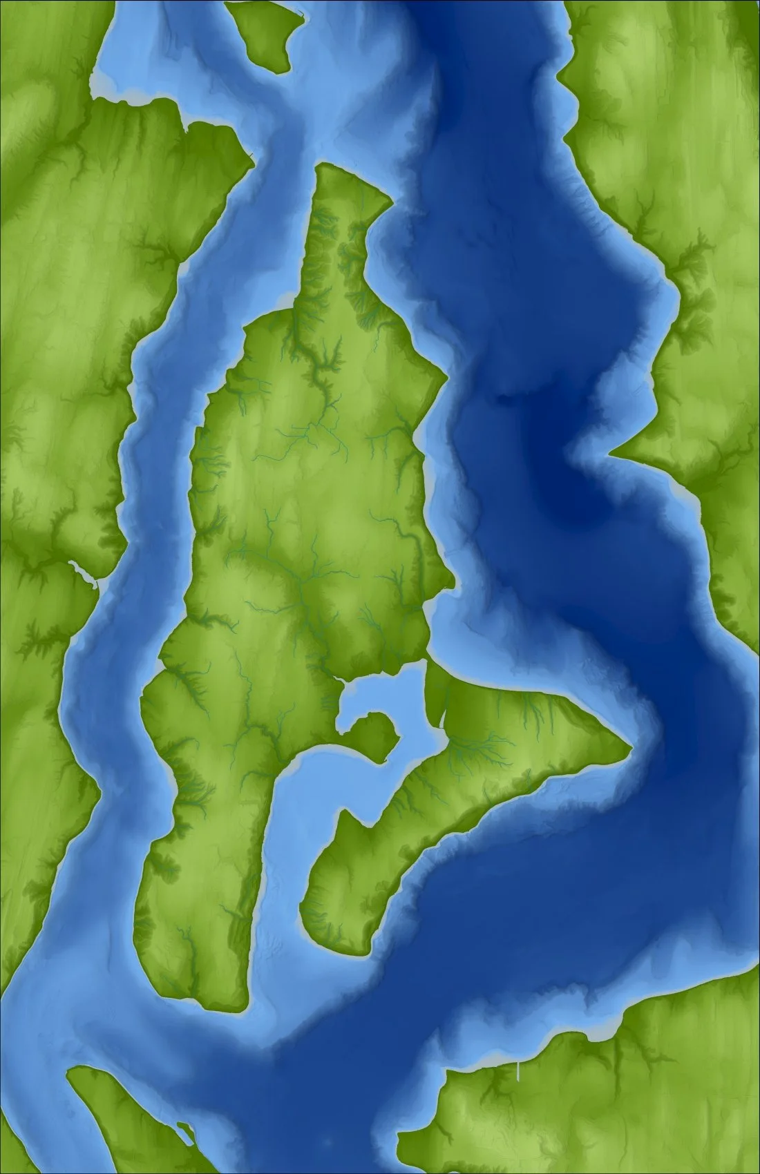
Topography / Bathymetry (for Heritage Museum's 3D model), 2023
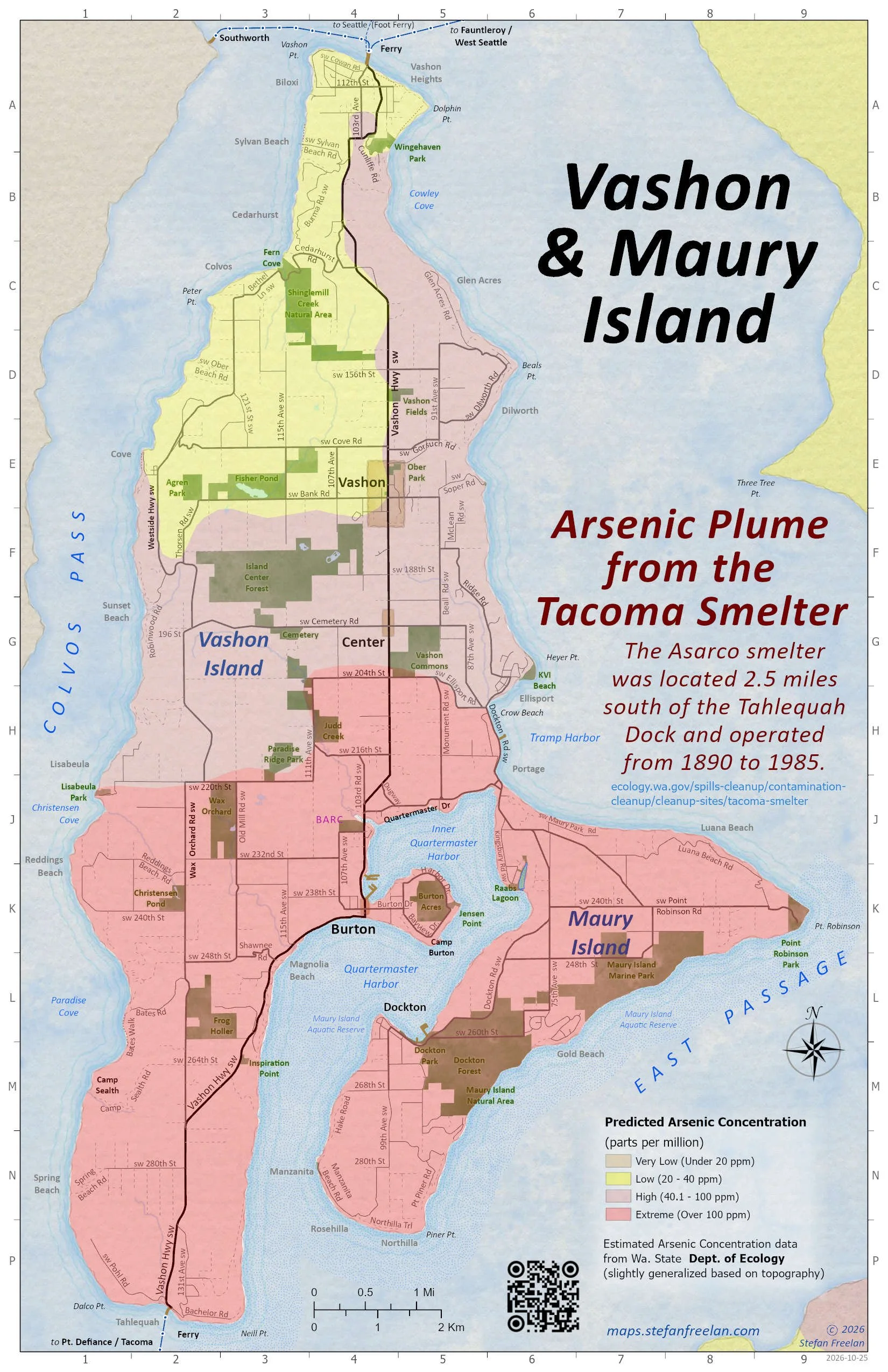
Arsenic Plume from Tacoma Smelter. 2026, 11x17 *
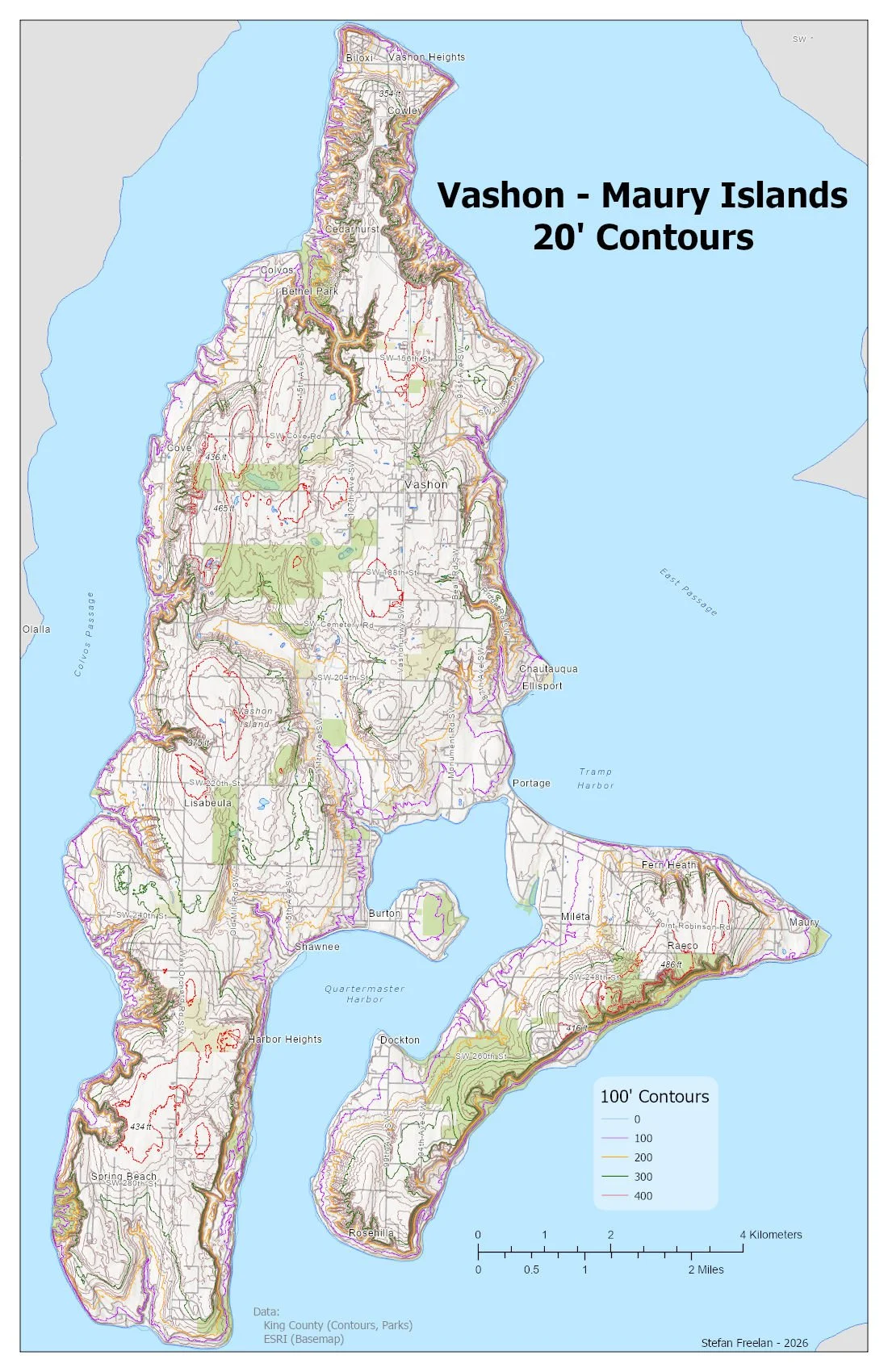
20' Contours. 2026, 11x17 *
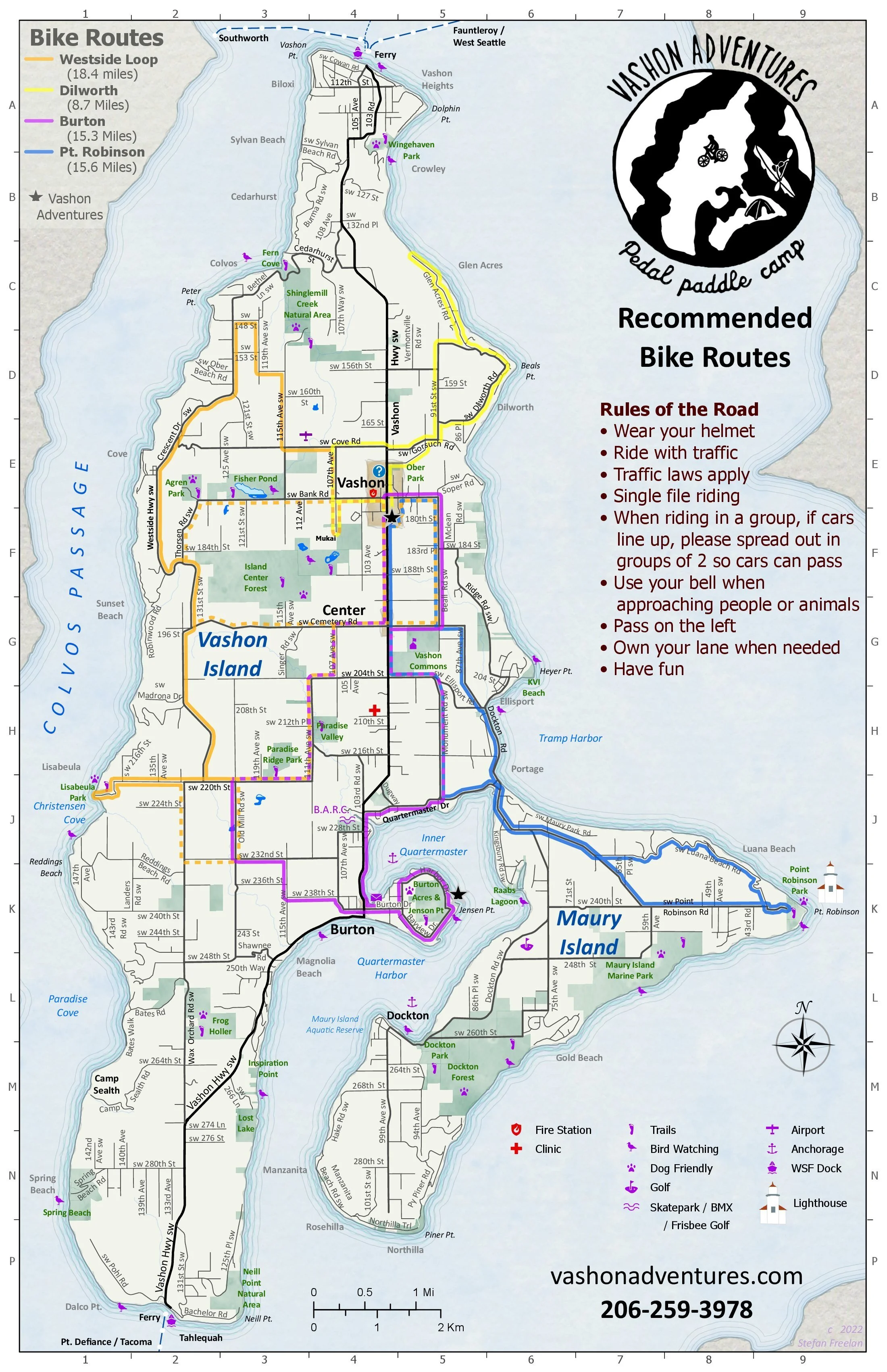
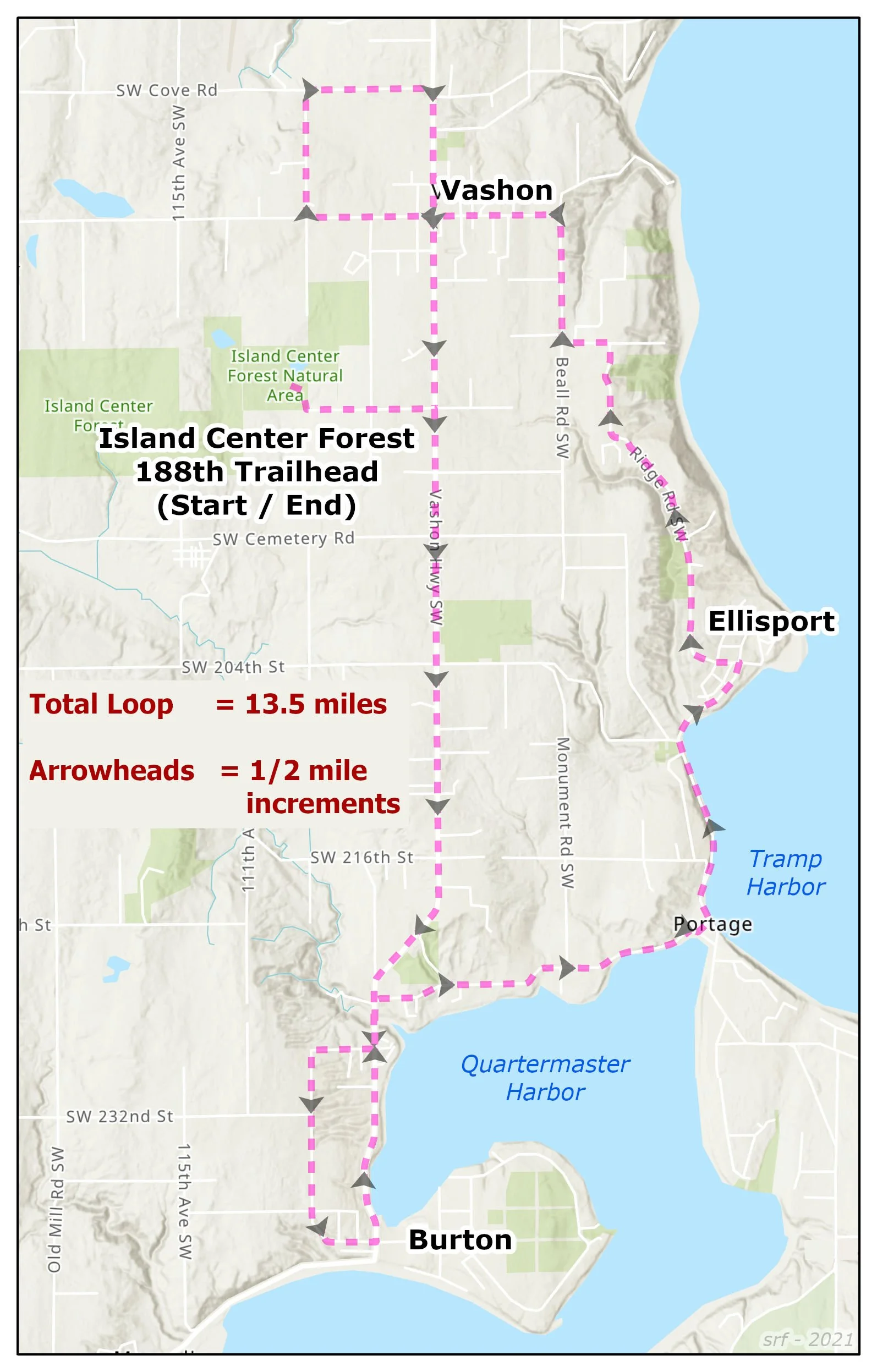
Vashon Adventures, Bicycle Routes. 2022, 11x17 *
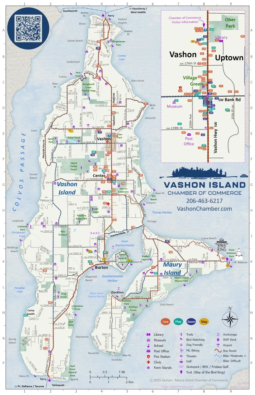
Chamber of Commerce Businesses. 2025, 11x17 *
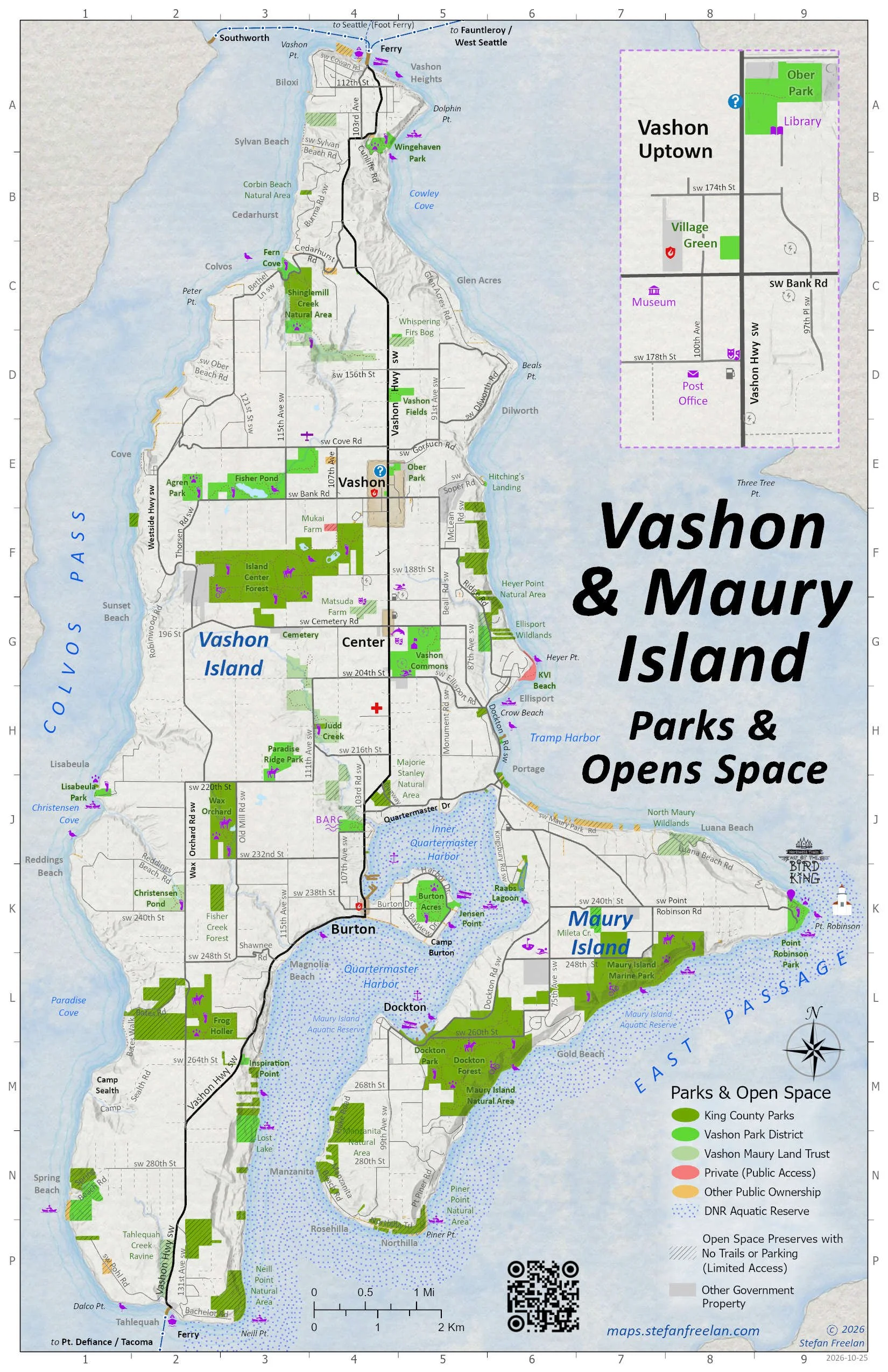
Parks & Open Space by Ownership / Management. 2026, 11x17 *
Topography / Bathymetry (for Heritage Museum's 3D model). 2023
Roads, Parks, Points of Interest. 2026
Vashon Adventures, Bicycle Routes. 2022, 11x17

Vashon Adventures, Bicycle Camping, Vashon Island. 2024, 11x17

Census Areas. 2024
20' Contours. 2026, 11x17
Chamber of Commerce Businesses. 2025
Arsenic Plume from the Tacoma Smelter. 2026
Parks & Open Space by Ownership / Management. 2026
Archives / Drafts:
Vashon Chamber of Commerce 2025 Map
Vashon Chamber of Commerce 2024 Map
Vashon Chamber of Commerce 2023 Map
Vashon Chamber of Commerce 2023 Brochure & Map
Vashon Chamber of Commerce 2021 Map
Vashon / Maury Island Census Areas (2024)
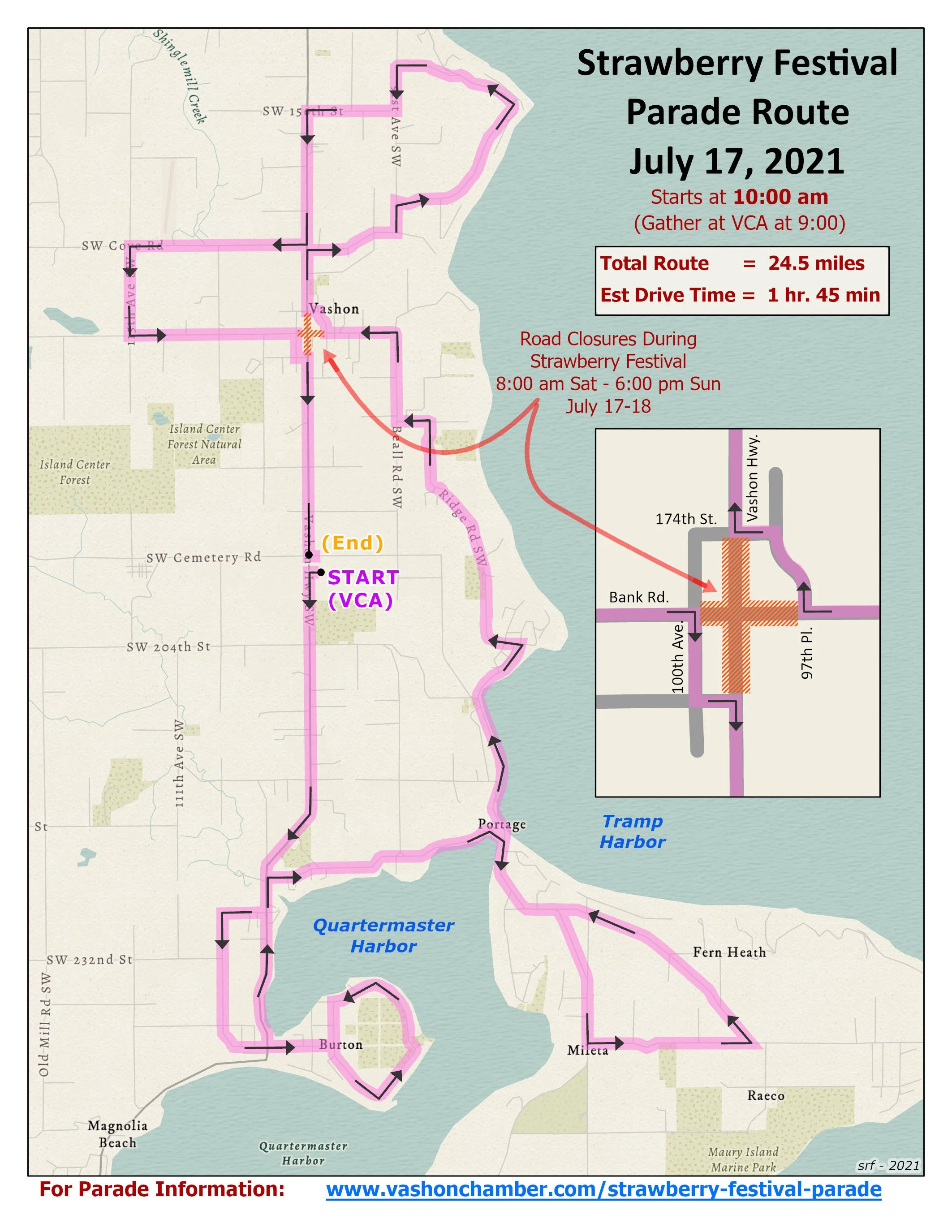
Strawberry Festival Parade Route (during Covid) (2021)
Vashon Biden Inauguration Parade Route (2021)
* Geo-Enabled .pdf file (can be used with mobile device) - See notes on using geo-pdf files (and additional files).
Vashon Island Web Maps

Vashon Maury Island Archival Map Viewer
(online collection of archival maps dating back to 1867)
Vashon-Related Map Links:
Vashon-Maury Island Land Trust
Trails & Preserves (w/maps)
King County Parcel Viewer
King County Bus Routes (118, 119)
WA Dept of Ecology: Tacoma Smelter Plume
See also interactive map
WA Dept of Natural Resources Maury Island Aquatic Reserve
Other Cartographers