The Ish River
A few years after I published my map of the Salish Sea & Surrounding Basin I stumbled across David McCloskey’s Ish River Country map, created in 1987. McCloskey adopted the term Ish River from Robert Sund’s book of poetry by the same title. “Ish” (or more appropriately, “mish”) comes from the indigenous languages of the region and roughly translates to ‘people.’ Sund coined the term Ish River Country to refer to the area that included the Duwamish, Sammamish, Samish, Skokomish, Skykomish, Snohomish, and Stillaguamish Rivers (all of which drain to Puget Sound, making ‘Ish River Country’ a more appropriate label for the Puget Sound than for the entire Salish Sea, though there are a few northern rivers as well, such as the Squamish River in BC). Much to my surprise and delight the Ish River Country map, which predates mine by 20 years (and indeed predates the introduction of the term Salish Sea as well), delineates almost the exact same region as I used as the ‘basin boundary.’ The Ish River Country map does not identify what was used to establish the outer boundary of the region, but it is clearly the hydrological watershed boundary for the vast majority of the region. As with the boundary used for the Salish Sea & Surrounding Basin map, the region used for the Ish River Country map excludes the full watershed of the upper Fraser River, and thus does not follow a true watershed boundary.
McCloskey’s focus was on the rivers of the region as opposed to the sea. Indeed, his map does not even label the marine waters (perhaps in part because no single name existed at the time). In correspondence he told me they sometimes referred to it as the Ish River Sound. Had the term Salish Sea existed at the time, perhaps he would have used it.
The Ish River Country map, similar to the map of the Salish Sea & Surrounding Basin, omits the human imprint on the land, leaving cities, roads and jurisdictional boundaries off the map entirely. Even more so than the Salish Sea & Surrounding Basin, McCloskey’s map is a beautiful example of a minimalist simplicity that wonderfully tells a story of the place. For a fuller narrative of his map, see McCloskey’s narrative The Ish River Map Story.
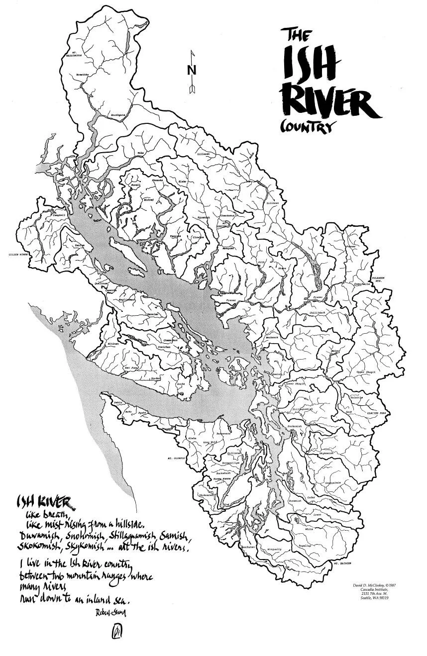
Ish River Country, David McCloskey, 1987
McCloskey also produced a map of Cascadia in 1988. This was re-created in association with Benchmark Maps as a bioregional geography map of Cascadia: A Great Green Land in 2015, available for purchase from the Cascadia Institute.
More recently McCloskey and Benchmark Maps have produced a new map The Ish River – Lillooet Country with the Salish Sea, with essentially the same extent as his earlier Ish River Country map (and my Salish Sea & Surrounding Basin map).
The Ish River – Lillooet Country with the Salish Sea, McCloskey / Benchmark Maps, 2021